How Earth Observation Data is used by Target Malaria

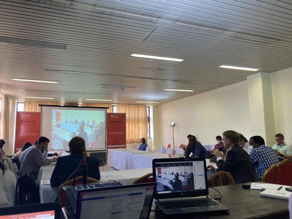
Group Earth Observation (GEO) is an intergovernmental partnership that improves the availability, access, and use of earth observations data for a sustainable planet. The organization annually hosts a “GEO Week”; this year it was held in Accra, Ghana under the theme ‘Earth Observation and Health: Early Warning Systems and beyond.’
As a coordinator for Geographic Information System (GIS) for Target Malaria, I had the pleasure to present on the topic: “How earth observation data is used by Target Malaria” on behalf of the Outreach Network for Gene Drive Research.
This event aims to promote the One Health concept and highlight how Earth Observations can offer valuable insights into health decision-making. Earth Warning Systems, in particular the Early Warning Early Action (EWEA) can help prepare community stakeholders for strategic management of health activities and concerns.
As a coordinator for Geographic Information System (GIS) for Target Malaria Burkina Faso at the Institut de Recherche en Sciences de la Santé (IRSS), my research focuses on the dynamics of disease vector mosquitoes and the influence of geographical variables on the dynamics of vectors and diseases.
At Target Malaria, we use various sources of earth observation data such as:
- Free online imagery resources: Google Earth; ESRI; OpenStreetMap
- Digital Elevation Models (DEM)
- Very high-resolution multispectral satellite images purchased from remote sensing companies
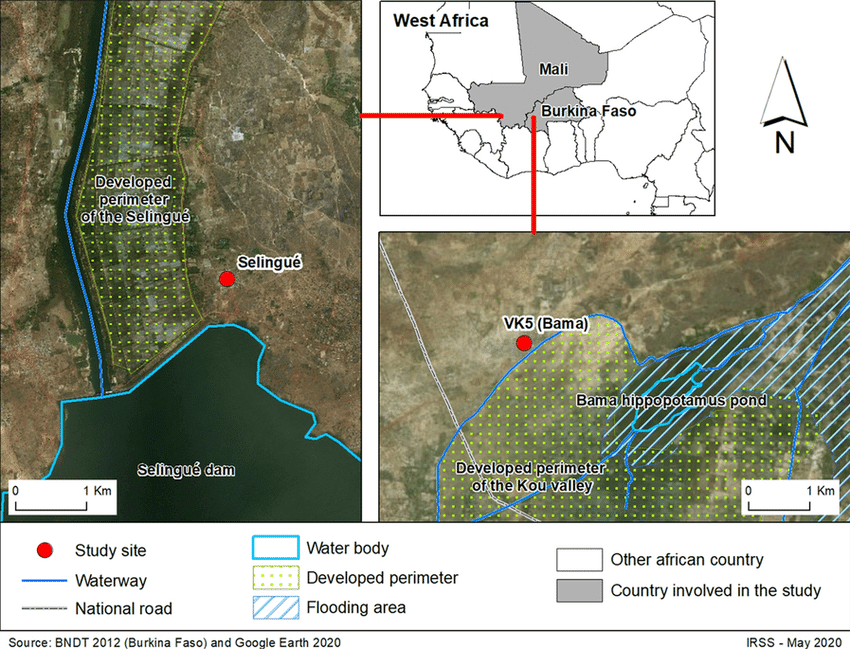
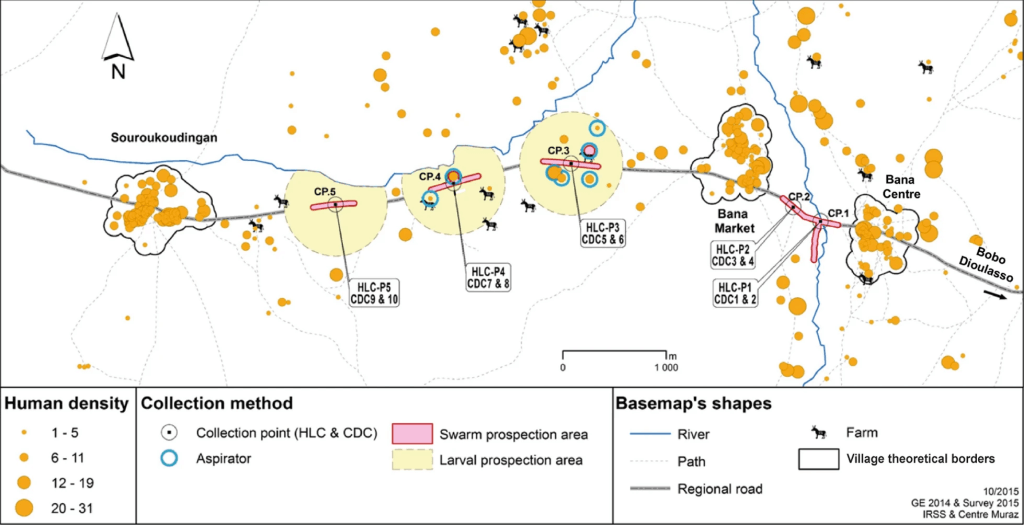
These spatial data are employed to digitalize base maps, to observe the topography of the study area, for spatial index calculations and to find water-rich areas for mosquito distribution modelling in Burkina Faso, Mali, and Uganda. For this purpose, I presented output of supervised classification from multispectral images, for both dry and wet seasons, that were combined with digital elevation models and field data with the focus being on two villages in south-western Burkina Faso (Souroukoudingan and Bana), where a lot of our work takes place. The objective is to determine the probable distribution of mosquitoes after the potential future release of the non gene drive genetically modified male bias mosquitoes. This work was required for the submission of the dossier to import the male bias strain.
The Earth Observation data plays a crucial role by helping Target Malaria design the future potential release of the non gene drive male bias mosquitoes. Without such data, it would be difficult visualize the release design, to track, observe and to potentially monitor the released mosquitoes.
Feedback from Geo Week participant was positive. Experts were interested to learn about how we, as a gene drive research project, are using EO data on a local scale (few square kilometers), as most of the works presented were done at countries’ scale or beyond. I also noticed some spatial models that we could explore to improve our GIS process.